
Before looking at the last set of engine house at the South Caradon Mine I have had quick diversion into maps, a diversion that gave me the opportunity to play on the OS maps online website.
The South Caradon explored with Grid References
‘Minions- An archaeological survey of the Caradon Mining District‘ by Adam Sharpe without doubt is the definitive resource on the industrial archaeology of Caradon Area. And now that the OS Maps on-line website has arrived there is a wonderful opportunity for armchair archaeology. Type in the grid references in the book into the webpage search, pinpoint the site and then switch on the aerial layer- a great way to read the book. To reduce some of the typing for the South Caradon mine here is a list of hyperlinks to the locations. Enjoy exploring.
Copies of the book are hard to come by, so grab one when you see it.
Click to search for the book on Amazon>
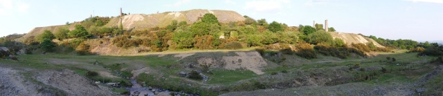
Western Hillslopes
- Sump Shaft pump engine SX 26513 70048
- Sump Shaft Capstan Chimney SX 26519 70022
- Sump Shaft Pond SX 26534 70074
- Sump Shaft whim SX 26558 70033
- Sump Shaft whim pond SX 26583 70016
- Quarry (magazine) SX 26554 69994
- Pearce’s Shaft SX 26643 70017
- Pearce’s Pond SX 26660 70008
- Webb’s Shaft SX 26746 70212
- Whim plat SX 26440 70137
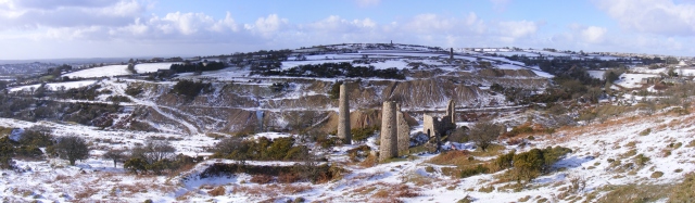
Southern hill slopes
- Jope’s Shaft pond SX 26520 69818
- Jope’s magazine SX 26530 69796
- Jopes whim SX 26580 69757
- Clymo’s Shaft SX 26817 69860
- Rule’s Whim SX 26950 69887
- Rules Pond SX 26980 69900
- Rules Pond SX 27006 69892
- Holman’s Pumping Engine SX 26955 69841
- Unknown engine house SX 27152 69916
- Kitto’s Pump engine SX 27383 69972
- Kitto’s pond SX 27355 69984
- Kitto’s Whim SX 27412 69968
- Kitto’s Man Engine SX 27404 69978
- Kitto’s Adit SX 27404 69978
- Tramway terminus SX 27400 69916
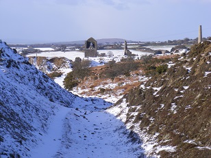
Seaton Valley floor
- Tramway yard terminus SX 26476 69976
- Stamping and crushing engine SX 26446 69840
- Stamping and crushing engine chimney SX 26465 69850
- Cobbled flooring SX 26432 69980
- Subsidiary building SX 26448 69945
- Small Chimney SX 26430 70004
- Donkey Pond SX 26472 70044
- Smaller pond SX 26424 70017
- Yard SX 26455 69990
- Drys Chimney SX 26463 69980
- Smithy SX 26462 69916
- Stores SX 26465 69886
- Substantial building SX 26464 69862
- Account House SX 26465 69850
- Main adit SX 26438 69990
- Lower adit SX 26430 69741
A map of South Caradon Mine for Kindle
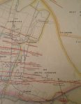 Brenton Symons’ 1863 map of the Liskeard mining district is reproduced in ‘The Liskeard Mining District in 1863’.

Pingback: Exploring South Caradon Mine by Maps | navsbooks