Rule’s Shaft Pumping Engine at South Caradon Mine

Rule's engine house at South Caradon mine

The resurrection of the ‘Views of South Caradon’ website now moves out of the Seaton Valley to the engine houses that lie on the southern slopes of Caradon Hill.

The Ruin of Rule’s Engine House

This engine house is a stark contrast to its nearby neighbor at Holman’s shaft. Whilst Holman’s massive house dominates the southern slopes of Caradon Hill, Rule’s has only one corner standing to full height, the remainder being no more than a pile of rubble.

Rules Engine House at South Caradon Mine

A military exercise was the probable cause of the transformation of this Cornish engine house into collapsed ruins.  It originally housed a 40″ engine (Kenneth Brown), which proved to be insufficient to pump the mine as it expanded eastwards, and therefore was supplemented by its larger neighbor. The engine at Rule’s was installed in 1863 as a result of the mine extending its workings eastwards, away from its original focus in the Seaton Valley.  The engine was originally working at South Garras Mine, near Truro. Webb and Geach state that the engine was 60″.

Click here for a map of the Holman’s/Rule’s engine house complex>

Rule’s ruined condition makes it a challenge to determine its layout; its shaft was on the eastern side, and its boiler house to the north. These boilers may have shared a chimney with Holman’s shaft boilers.


41f3tbQ+CnL._SL500_[1]As seen on the Cover of the Trevithick Society’s re-print of ‘Webb and Geach’

South Caradon’s Rule’s shaft engine house the ruins adorns the cover of ‘History and Progress of Mining in the Liskeard and Caradon District’.

Click here to find the paperback on Amazon>

The President Steam engine- an update

Protecting the only Cornish Engine House in the USA

screenshot_2017-06-13-12-07-40_kindlephoto-18444209.jpgA quick break from the South Caradon series of posts to pass on some news about from across the Atlantic. Here is an update from Mark Connar on activity a the President Engine house, a house that had close connections with William West.


Work by Lehigh University

Lehigh University (the property owner) has now leveled the land surrounding the engine house, removed much of the destructive vegetation and has installed a protective fence around the engine house and the pump shaft immediately in front of the engine house. Unfortunately, the site continues to experience vandalism largely in the form of graffiti tagging and Lehigh is seeking solutions to this problem.
The Lehigh University has submitted at the end of February an application for a preservation planning grant to the PA Historical and Museum Commission. Lehigh, through the grant process, is requesting funding to evaluate the engine house and other remains on the site as well as the potential to convert the site into a public recreation/heritage location. Some of the activities contemplated as part of the grant includes structural/stabilization analysis of the engine house and the creation of a 3-D scan of the existing structure to establish a current condition baseline. Other activities include a cultural resource assessment and other property survey work which would support future development.

Lehigh has an innovative, award winning academic program called the Technical Entrepreneurship Capstone program. One of the Capstone classes underway for this Spring and next Fall semester involves 7 undergraduate students, with concentrations in multiple disciplines, working together to develop heritage park concepts and to create an animated virtual reality model of the President pumping engine. The funding for this initiative is also being partially provided by Lehigh’s Office of Sustainability Green Fund. It is very exciting to follow the progress of these motivated students!”

A boiler is found

President Engine Boiler
Access to take the pictures was courtesy of American Atelier, Inc.r

“One of the boiler’s riveted 30-foot-long steam drums was found to still exist, resting on saddles on the mud floor basement of a former furniture factory on Front Street in Allentown  still in use as a water holding tank!”

A date for the diary

Michael Kaas, Dr. Gerard Lennon and Mark Connar are scheduled to present on the Ueberroth Mine/President Pump and how Lehigh University students are supporting the preservation efforts at the 47th Annual Conference of the Society for Industrial Archeology in Richmond Va. in June 2018.


wpid-wp-1415226867597.jpeg William West the Last Great Cornish Engineer

William West was the uncle of John West, the President engine’s engineer. ‘The Last Great Cornish Engineer’ tells the fascinating rags to riches story of William West of Tredenham.


Jope’s Shaft- The maps

The area around South Caradon Mine’s Jope’s shaft in maps and images

Jope's shaft seen from the west

The rescuing of the old ‘Views of South Caradon’ website has just gained an additional purpose . I will be assisting a mining history group interpret this amazing Cornish mining landscape in a couple months time, so this posts will build towards a resource for their visit.

Jope’s shaft is a fascinating little corner of South Caradon Mine. It is South Caradon’s most westerly shaft on the rich-long run of southern lodes, located on the eastern slopes of the valley at the bottom end of the Seaton Coombe.

The shaft can boast having the most complete engine house structure on the mine, despite of its cloak of Ivy. However, it also possess one of least well preserved engine houses, no more than a mere pile of masonry hidden among the trees.

This is shaft with some historic remains, for this is where William West built the last man engine in Cornwall. It is also where he may have built one of the rare examples of a Sim’s compound engine.

Jope’s Shaft in Maps

Jope’s Shaft area in 1863

Jope's Shaft in 1863

This extract of Brenton Symons’s 1863 map shows the pumping house as P.E and whim engine as W.E. Lodes are shown by the red lines and the cross-course by light grey. The shaft is shown sunk pm Jope’s Lode, close west of the cross-course.

The ‘View of South Caradon map’
jopemap

Not the most cartographic accurate map I know, and the style is definitely leaning towards the ‘simplistic’, but this map rescued from my now long-dead  website shows well the features around the shaft. One omission is the possible site of a steam capstan engine on the shaft side of the boiler house.

Ordnance Survey 2018

The 2018 map shows the engine house, boiler house, and magazine; it does not however show the chimney and remains of winding engine house.

Click here for full map>

JopesOS

Google Air

The engine house and stack are clear, but the whim/man engine and the linking trench are hidden beneath the line of trees.

1886 OS Map

Cornwall XXVIII.SW (includes: St Cleer.) Surveyed: 1881 to 1882
Published: 1886

The National Library of Scotland have an excellent version of this map on-line. But, unfortunately due to copyright restrictions this cannot be re-produced here.

Click here to view map> 

Some structures in the area

The Magazine

This small structure lies to the north-east of the engine house. It would have housed the gunpowder required by the miners for blasting.

Powder Magazine at Jope's Shaft

The steam Capstan

Jope's shaft steam Capstan

On the south side of the boiler house are some loadings and a pit that may have been associated with some sort of machinery. The Minions Survey suggests that this may have been the site of a small steam capstan. If so, this is another link with William West, who introduced the use of steam capstans in Devon and Cornwall. This part of the remains has undergone some changes as part of the Caradon Hill project building stabilization work.


wp-1453408124105.jpeg
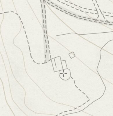
A Victorian Map of the area

Brenton Symons’s 1863 map of the Liskeard mining district is available in Kindle Format, and it is free for those with Kindle Unlimited.

Click here to visit the book’s page on Amazon>